![]()
![]()

 Presentation
A rather long Itinerary but of extreme interest and is not difficult. Advisable in spring or autumn.
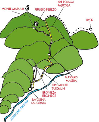
Description of the route
Departure from Savogna/Sauodnja, climb up towards Stefenig/Stiefinči, Tercimonte/Tarčmun, Vartacia/Vartača, Masseris/Mašera,
Val Polaga/ Paluoga, Pelizzo Refuge.
Length
The total length of the route is approximately 15km. Here are the kilometres for each section:
Savogna/ Sauodnja-Masseris/Mašera approximately 6km;
Masseris/Mašera-Pelizzo (via val Polaga/Paluoga) approximately 9km.
Altitude
Approximately 1100 metres up to Pelizzo Refuge. Altimetry:
Savogna/Sauodnja 200m;
Tercimonte/ Tarčmun 644m;
Vartacia/Vartača 624m;
Polaga/ Paluoga Valley 1221m;
Pelizzo Refuge 1325m;
Mount Matajur 1641m.
Level of dificulty:
Medium


.  Departure from the tavern of Crisnaro/Kranjae
of Savogna/Sauodnja, altitude 200m, where it
is possible to park near the bowling green. Just
passed the bridge on the Alberone/Aborna river
take the road on the left towards Ieronizza/
Jeronišče, between beautiful meadows. After
approximately 500m there is a junction: take the
tarmac road on the right up to Stefenig/Stiefinči.
Here the road becomes a dirt windy road and
goes up towards Tercimonte/Tarčmun, 644m,
Departure from the tavern of Crisnaro/Kranjae
of Savogna/Sauodnja, altitude 200m, where it
is possible to park near the bowling green. Just
passed the bridge on the Alberone/Aborna river
take the road on the left towards Ieronizza/
Jeronišče, between beautiful meadows. After
approximately 500m there is a junction: take the
tarmac road on the right up to Stefenig/Stiefinči.
Here the road becomes a dirt windy road and
goes up towards Tercimonte/Tarčmun, 644m, 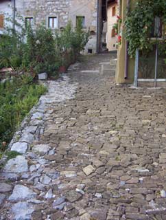 a
panoramic position on an isolated summit on the
last offshoot of Matajur spanning between the
Alberone/Aborna and the Rieca/Rieka valleys.
Before entering the village there are meadows,
vegetable gardens and orchards. All of a sudden
there is a view of Matajur crowned by apple
trees which in spring are like white waterfalls
and in front there are all the little villages settled
on its slopes: Masseris/Mašera, Iellina/Jelina,
Dus/Duš, Montemaggiore/Matajur, Stermizza/
Starmica, Pechinie/Pečnije. After 3km we reach
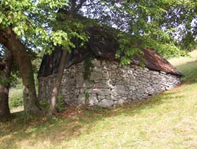
Tercimonte/Tarčmun, a village once famous for
the fabrication of rakes; today a few rakes are
still produced by hand. In the little square of the
nucleus below there is a fountain where horses
can drink. Following the road we climb up to thehighest point where the church of San Giovanni
(saint John) is situated with its square of old lime
trees. From here a paved mule track descends
into the woods and then opens out onto the col
of Vartacia/Vartač (with a bar/restaurant). A
little further on, on the road that goes up towards
Masseris/Mašera, take the forest road on the right
that a little after 800m crosses Sentiero Italia
(marked with the red and white Cai trail sign
n°736) arriving from Cepletischis/Čeplešišče.
Follow the path to the left, which initially is a
steep track crossing meadows and then at altitude
888 becomes partially flat and flows into the
forest road that comes from Masseris/Mašera.
The path continues with numerous shortcuts but
for commodity it is worth following the road that
passes under Mount Kal and which arrives to the
stavoli of Tamoršča. We are practically following
the main road Rommel took in his conquest of
Mount Matajur during the Battle of Caporetto. See itinerary n° 6, on page 70.
a
panoramic position on an isolated summit on the
last offshoot of Matajur spanning between the
Alberone/Aborna and the Rieca/Rieka valleys.
Before entering the village there are meadows,
vegetable gardens and orchards. All of a sudden
there is a view of Matajur crowned by apple
trees which in spring are like white waterfalls
and in front there are all the little villages settled
on its slopes: Masseris/Mašera, Iellina/Jelina,
Dus/Duš, Montemaggiore/Matajur, Stermizza/
Starmica, Pechinie/Pečnije. After 3km we reach
Tercimonte/Tarčmun, a village once famous for
the fabrication of rakes; today a few rakes are
still produced by hand. In the little square of the
nucleus below there is a fountain where horses
can drink. Following the road we climb up to thehighest point where the church of San Giovanni
(saint John) is situated with its square of old lime
trees. From here a paved mule track descends
into the woods and then opens out onto the col
of Vartacia/Vartač (with a bar/restaurant). A
little further on, on the road that goes up towards
Masseris/Mašera, take the forest road on the right
that a little after 800m crosses Sentiero Italia
(marked with the red and white Cai trail sign
n°736) arriving from Cepletischis/Čeplešišče.
Follow the path to the left, which initially is a
steep track crossing meadows and then at altitude
888 becomes partially flat and flows into the
forest road that comes from Masseris/Mašera.
The path continues with numerous shortcuts but
for commodity it is worth following the road that
passes under Mount Kal and which arrives to the
stavoli of Tamoršča. We are practically following
the main road Rommel took in his conquest of
Mount Matajur during the Battle of Caporetto. See itinerary n° 6, on page 70.


 For every metre of height gained the view is
evermore spectacular and opens out onto the
valleys. The road ends in Polaga/Paluoga Valley.
Behind the border there are beeches here and
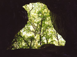
there, a field with numerous small dolines and
a very small “mirror of water”, the lake of Val
Polaga/Paluoga valley. Return on our steps for
approximately 200 metres and take the marked
path on the right that goes up to the little valley up
to 1315 above sea level, on the Italian-Slovenian
border. Here on the left take (on the right) there
is a very long forest road that goes down to Avsa
and Livek. (See itinerary n° 6 on page 69) the path
that links once again to Sentiero Italia and that goes
round the slopes of Mount Glava, passes through
the Skrila spring and reaches Pelizzo Refuge.
For every metre of height gained the view is
evermore spectacular and opens out onto the
valleys. The road ends in Polaga/Paluoga Valley.
Behind the border there are beeches here and
there, a field with numerous small dolines and
a very small “mirror of water”, the lake of Val
Polaga/Paluoga valley. Return on our steps for
approximately 200 metres and take the marked
path on the right that goes up to the little valley up
to 1315 above sea level, on the Italian-Slovenian
border. Here on the left take (on the right) there
is a very long forest road that goes down to Avsa
and Livek. (See itinerary n° 6 on page 69) the path
that links once again to Sentiero Italia and that goes
round the slopes of Mount Glava, passes through
the Skrila spring and reaches Pelizzo Refuge.
For those who would like to reach the top of
Matajur they can follow the main path from
Pelizzo Refuge.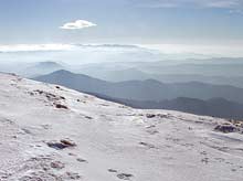
ALTERNATI VE FOR THE DESCENT:
from Polaga/
Paluoga valley it is possible to descend along the
forest road to Masseris/Mašera. From here we
descend along the bendy tarmac road down to the
village so as to take the shady forest road on the
right up to Stermizza/Starmica, and then downhill
along a wide road free from traffic that with lots of
bends takes to the old mill of Ieronizza/Jeronišče.
Again there is a forest road along the Alberone
river which runs between half abandoned small
fields and orchards and takes to the main nucleus
of Savogna/Sauodnja, a little higher with respects
to the road, from where in a few minutes you can
go down to the tavern of Crisnaro/Kranjac.
